LZ Center (BT 052 250)
If you have additional photos of LZ Center, please contact wr9r@aol.com
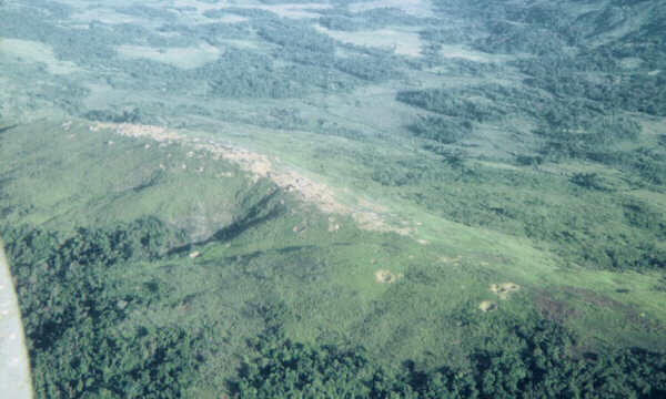
LZ Center (BT 052 250) looking westward. Photo by Dave Bliss
(C/1-6 Inf 1967-68). The
firebase was the scene of intense combat in May 1968. On the
night of 5 May 1968, an NVA
unit attempted to breach the perimeter at the steepest point (just
to the left center of this photo).
They made it to within 30 meters of the command bunker, but were stopped
when the defenders
threw "cases" of hand grenades down on them. For the story, use
this
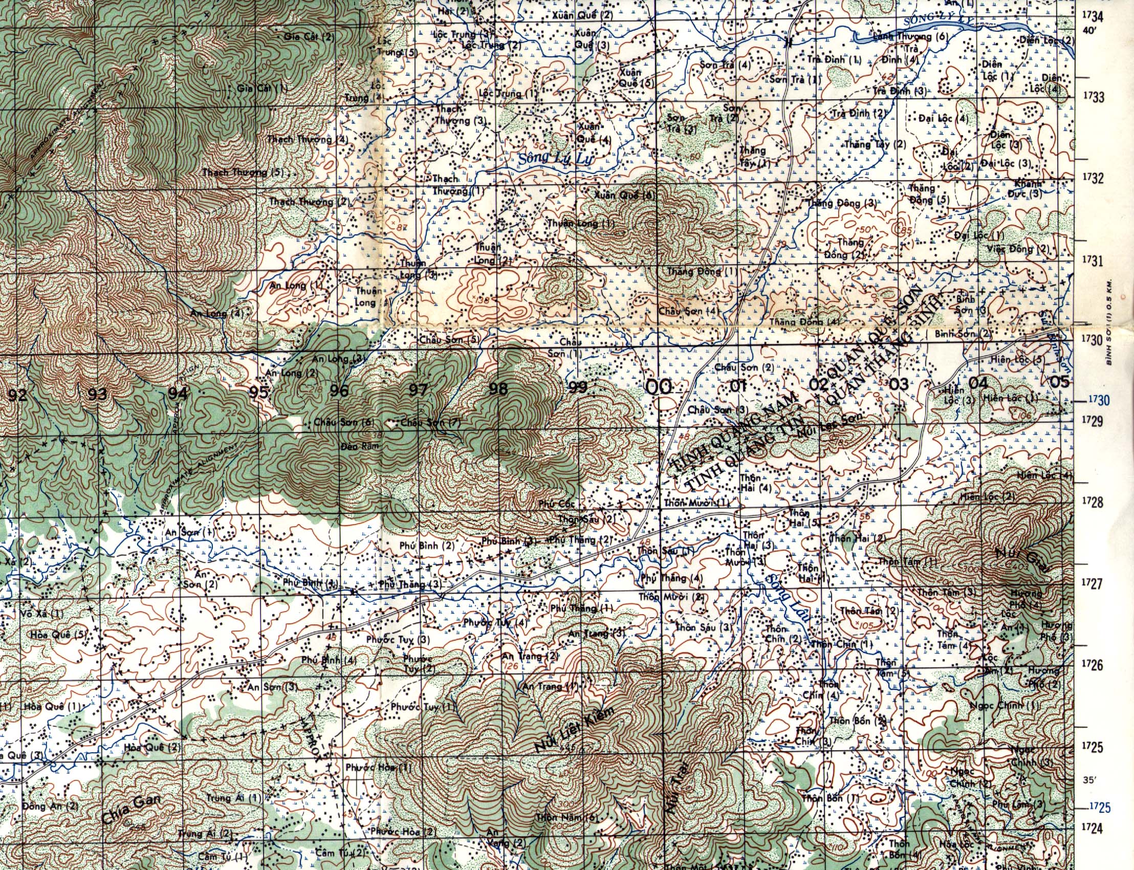
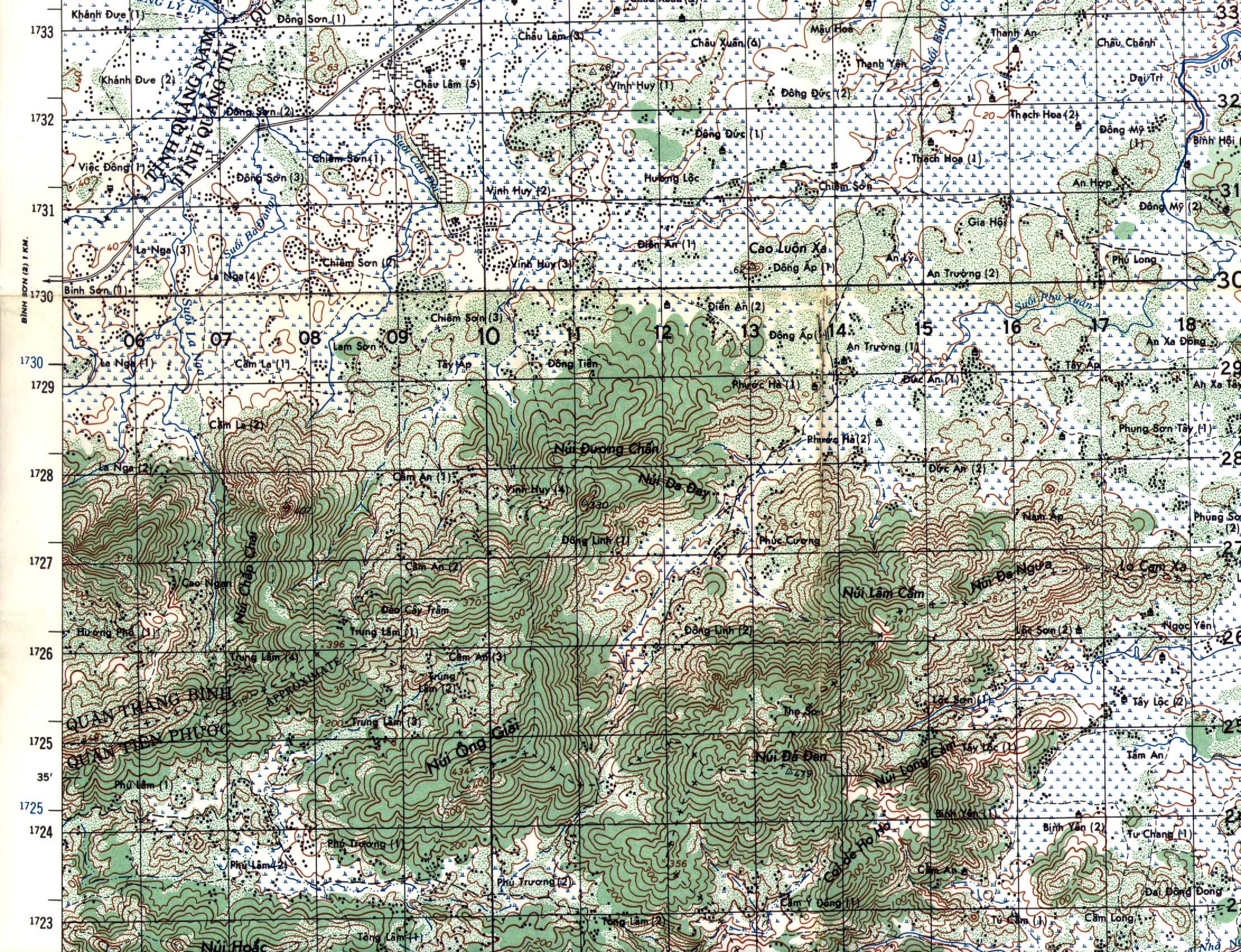
link. On the map below,
LZ Center was located on the western end of the ridge (shown
on grid line 25) that runs generally
east and west. The ridge marked the boundary between Quan Thang
Binh and Quan Tien Phuoc.
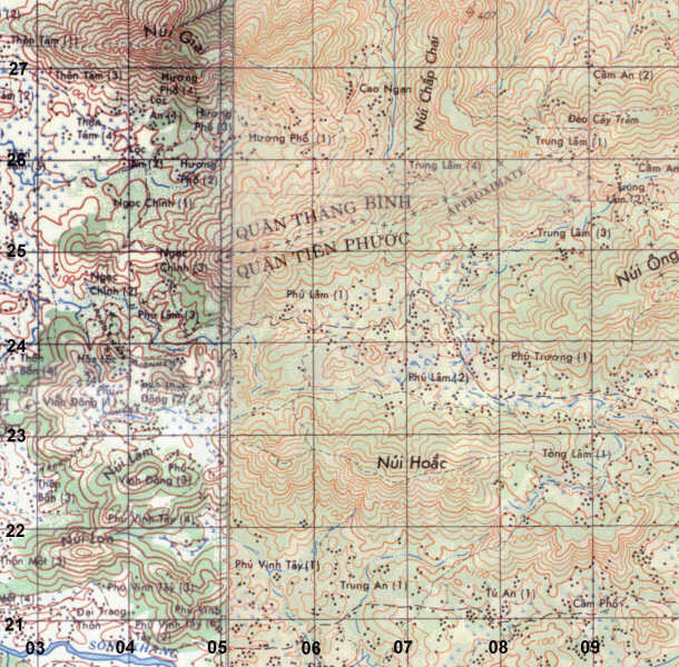
[Note: this is a composite map from Series L7014
On left, Sheet 6640-3,
Hiep Duc; on right,
Sheet 6640-2, Tam
Ky.]
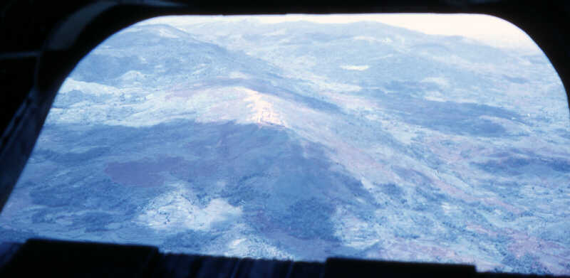
LZ Center (BT 052 050) looking east northeast out the back end ramp
of a CH-47 helicopter.
Nui Hoac Ridge is just out of view to the extreme right of this photo
provided by Bob Leahy, an
artilleryman from B/3-82 Arty (105mm howitzers) who served at LZ Center
during 1969-70.
LZ West was directly below the chopper when Bob snapped this photo.
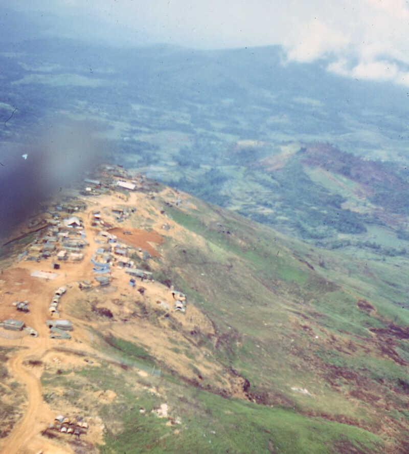
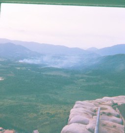
LZ Center, looking west southwest down the ridge line toward LZ West
(AT 990 251) in the
distance (obscured by clouds). Photos by Bob Leahy (B/3-82 Arty).
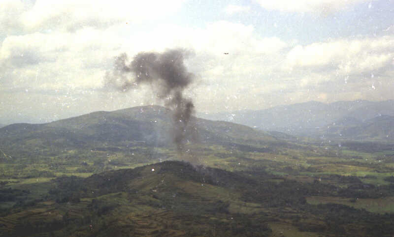
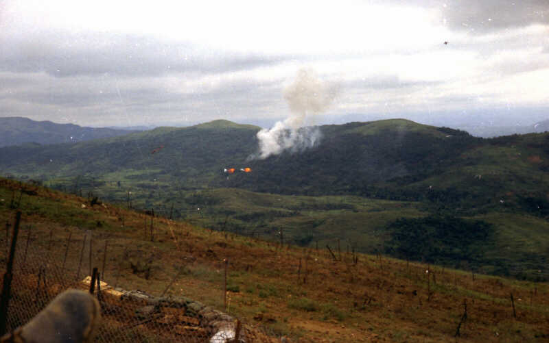
Air strike at BT 035 250, the small hill just off
the west end of the LZ Center. LZ West, the headquarters for
the 196th Infantry Brigade, is in the distance directly behind the black
smoke rising from the air strike. |
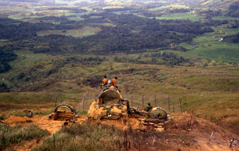
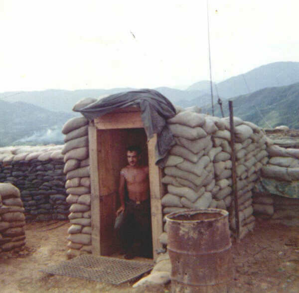
The soldiers on the bunker (below right) are located
at
the far western tip of LZ Center, with a view that oversees
the area just to the right of the air strike.
. |
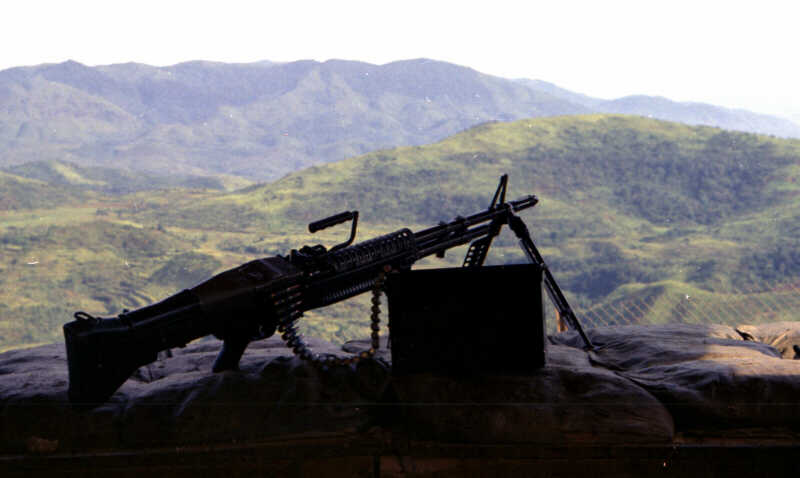
This great photo from Bob Leahy (B/3-82 Arty) was taken in 1970 from
inside the bunker shown
above at the western tip of LZ Center. Note the chain link fence
designed to detonate rocket
propelled grenades (RPGs) that might be aimed at the bunker.
The air strike pictured above
hit the right slope of the hill just behind the silhouette of the M-60
machine-gun. LZ West rises
in the distance, just above barrel of the machine-gun.
 |
(Left) Bob Janke's view looking southeast toward
an air strike in 1968 near the east end of Nui Hoac Ridge. (Above)
An air strike at BT 07 23 on the slope of Nui Hoac Ridge in 1970.
An F-4 is visible to the right of the rising smoke. (Leahy photo). |
Additional photos of LZ Center and the surrounding are are available
here and at this link.
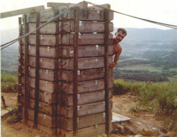
Photos below provided by Bob Janke (C/6-11 Arty 1968)
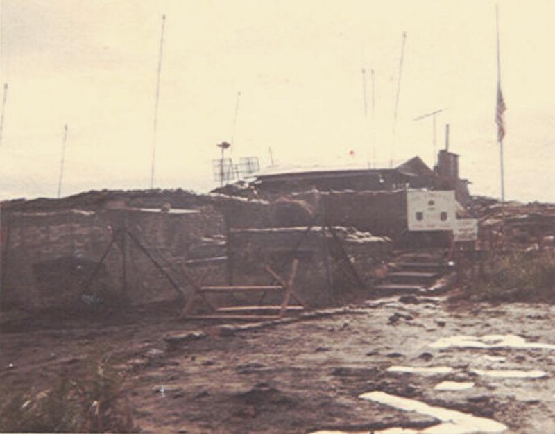
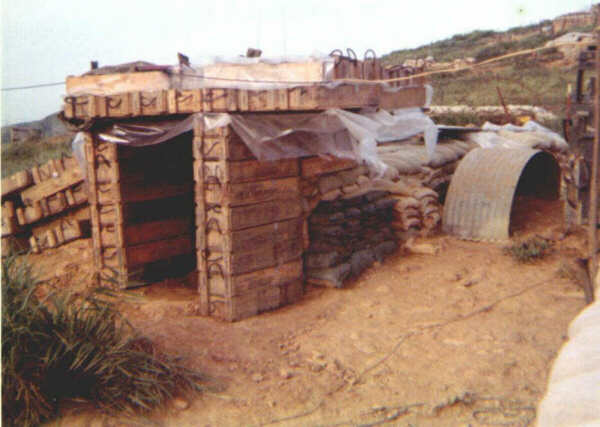
(Above) Tactical Operations Center TOC at LZ Center
Photo provided by 3-21 Inf, the Gimlets.
(Right) The artillery Fire Direction Center at LZ Center,
looking southeast toward the end of Nui Hoac. |
 |
(Above) Anti-aircraft (or counter mortar radar)
installation at LZ Center. (Right) One of the artillery personnel
bunkers on the southwestern side of LZ Center in 1968. |
 |
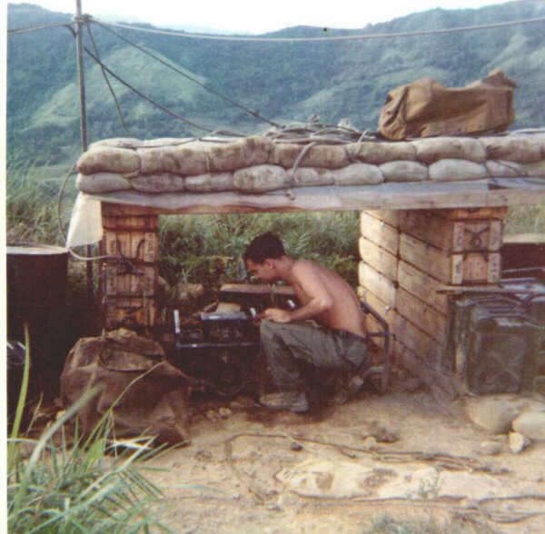
(Above) Shower facilities at LZ Center 1968.
(Right)
A generator at LZ Center 1968. The bulk of Nui
Hoac Ridge rises in the distance eastward from the firebase. |
 |
Use this link for additional
photos of LZ Center.
Select additional photos from the index at left or link to the 1st Bn
6th Inf Home
Page